


RICHLAND TWP Voting District, Mahaska County, Iowa
About
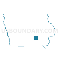
Outline

Summary
| Unique Area Identifier | 582785 |
| Name | RICHLAND TWP Voting District |
| County | Mahaska County |
| State | Iowa |
| Area (square miles) | 38.03 |
| Land Area (square miles) | 37.99 |
| Water Area (square miles) | 0.03 |
| % of Land Area | 99.91 |
| % of Water Area | 0.09 |
| Latitude of the Internal Point | 41.47120750 |
| Longtitude of the Internal Point | -92.81172030 |
Maps


Graphs
Select a template below for downloading or customizing gragh for RICHLAND TWP Voting District, Mahaska County, Iowa


Neighbors
Neighoring Voting District (by Name) Neighboring Voting District on the Map
- BLACK OAK TWP Voting District, Mahaska County, IA
- ELK CREEK TWP Voting District, Jasper County, IA
- LAKE PRAIRIE TWP PART W/O PELLA Voting District, Marion County, IA
- LYNN GROVE TWP Voting District, Jasper County, IA
- MADISON TWP Voting District, Mahaska County, IA
- PRAIRIE TWP W/O NEW SHARON Voting District, Mahaska County, IA
- SUGAR CREEK TWP Voting District, Poweshiek County, IA
Top 10 Neighboring County Subdivision (by Population) Neighboring County Subdivision on the Map
- Lake Prairie township, Marion County, IA (12,498)
- Prairie township, Mahaska County, IA (1,671)
- Lynn Grove township, Jasper County, IA (1,650)
- Black Oak township, Mahaska County, IA (753)
- Elk Creek township, Jasper County, IA (473)
- Richland township, Mahaska County, IA (472)
- Sugar Creek township, Poweshiek County, IA (434)
- Madison township, Mahaska County, IA (361)
Top 10 Neighboring Unified School District (by Population) Neighboring Unified School District on the Map
- Pella Community School District, IA (15,410)
- North Mahaska Community School District, IA (2,945)
- Lynnville-Sully Community School District, IA (2,846)
Top 10 Neighboring State Legislative District Lower Chamber (by Population) Neighboring State Legislative District Lower Chamber on the Map
- State House District 71, IA (30,841)
- State House District 75, IA (29,795)
- State House District 41, IA (28,844)
- State House District 72, IA (28,523)
Top 10 Neighboring State Legislative District Upper Chamber (by Population) Neighboring State Legislative District Upper Chamber on the Map
- State Senate District 21, IA (65,772)
- State Senate District 36, IA (59,364)
- State Senate District 38, IA (58,661)
Top 10 Neighboring 111th Congressional District (by Population) Neighboring 111th Congressional District on the Map
Top 10 Neighboring Census Tract (by Population) Neighboring Census Tract on the Map
- Census Tract 301, Marion County, IA (7,311)
- Census Tract 9502, Mahaska County, IA (3,415)
- Census Tract 3702, Poweshiek County, IA (3,048)
- Census Tract 409, Jasper County, IA (2,909)